Contact us
401 W. Kennedy Blvd.
Tampa, FL 33606-13490
(813) 253-3333
Assistant Professor of Environmental Studies Edna Fernandez-Figueroa is using drones to map coastal vegetation in Tampa Bay.
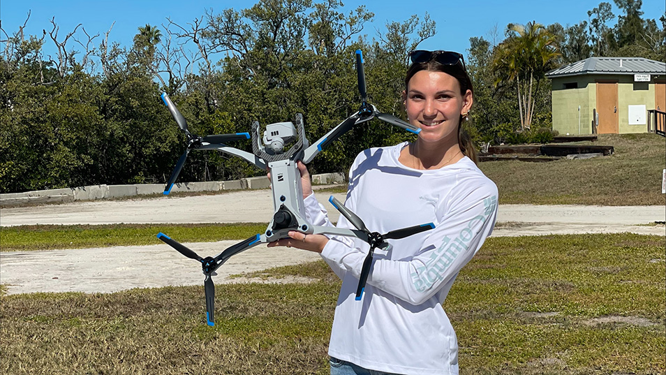
Delaney Mizell '27 assists Assistant Professor of Environmental Studies Edna Fernandez-Figueroa in using drones to map coastal vegetation in Tampa Bay. Photo courtesy of Fernandez-Figueroa
Assistant Professor of Environmental Studies Edna Fernandez-Figueroa is using drones to map coastal vegetation in Tampa Bay.
The goal is to map where mangroves exist on the coast, note invasive species and document whether there’s change over time — and if so, what that change looks like.
Environmental studies major Delaney Mizell ’27 is helping Fernandez-Figueroa on the project. They are concentrating on seven sites to take thousands of drone images that they stitch together to make a comprehensive picture of Tampa Bay.
After each flight, Mizell ensures all the data is present and processed, tagging the different types of coastal vegetation and areas of water recorded. They can then calculate how much of each vegetation is in a particular area and how it might change.
Mizell, who is from the Bahamas, spent last summer doing an internship there that included working in the mangroves, planting and doing restoration work. So, when the opportunity to collaborate with Fernandez-Figueroa came, she “jumped right on it,” Mizell said.
Some days, she said, she is “lucky enough” to go into the field with Fernandez-Figueroa.
But first, she had to learn how to operate a drone.
Fernandez-Figueroa is a certified drone pilot, and Mizell earned a recreational TRUST certification to work with her on the project. The Federal Aviation Administration requires all recreational drone pilots to pass the TRUST aeronautical knowledge and safety test.
“I was a little nervous, because I've never done anything like it,” Mizell said of operating the drone. “I had remote control helicopters when I was little, but, yeah, totally different things … that's a lot of money up in the air.”
Fernandez-Figueroa walked Mizell through the entire process, from how the thermal drone works, how to assemble it, and noting things to keep in mind before even beginning to fly, which Mizell notes, “is really important.”
Mizell learned how to fly the drone manually and also how to program it to “essentially fly itself,” she said.
“All you do is let it take off, and then it does its own thing, and it maps the area that you told it to map. It takes hundreds of images at a time, and that is the data we process,” Mizell said.
“These are such great tools and skills to have within this field, especially as we continue to advance. I've seen more and more people talk about the use of drones and how helpful they can be,” Mizell added.
The project with Fernandez-Figueroa has inspired Mizell to develop her own research questions about mangrove ecosystems and coastal vegetation ecosystems and to use the data that’s already collected to find the answers.
“It would be really cool to bounce off of this, to do something of my own, too,” she said.
More UTampa News

© 2024 The University of Tampa. All Rights Reserved.
Subscribe to News and UTampa Life

Contact us
401 W. Kennedy Blvd.
Tampa, FL 33606-13490
(813) 253-3333
© 2024 The University of Tampa. All Rights Reserved.
Subscribe to News and UTampa Life